UOMS
Real-time outage management and public communication tools
Trusted by utilities using:
Activity Feed
| Zone | Customers | Status |
|---|---|---|
| Zone 1 | 847 | Active |
| Zone 2 | 245 | Monitoring |
| Zone 3 | 155 | Resolved |
Activity Feed
| Zone | Customers | Status |
|---|---|---|
| Zone 1 | 847 | Active |
| Zone 2 | 245 | Monitoring |
| Zone 3 | 155 | Resolved |
Core Features
Real-time outage management that keeps your community informed
Real-time utility network traces
Automated customer notifications
Field crew coordination
Offline-capable mobile apps
Emergency response workflows
UOMS connects directly to your ArcGIS Utility Network to automatically identify affected customers, valves, and network segments during outages. Send mass notifications, coordinate field crews, and keep the public informed with real-time status updates.
What This Product Delivers
Real-time outage management and public communication tools
How UOMS Manages Utility Outages
Inputs from the Utility
- Water network data from ArcGIS Utility Network
- Outage reports from staff or sensors
- Customer and service area records
- Field crew locations from mobile apps
UOMS Coordination Hub
Runs traces, groups affected customers, and organizes work for operations teams.
Outputs for Operations
- Live outage map for internal use
- Suggested crew assignments and work areas
- Notification lists for customers and stakeholders
- Event history for after action review
Key Features
Utility Network tracing
Automatic identification of affected customers, valves, and network segments during outages.
Customer alert system
Send mass notifications via SMS, email, and web dashboards with real-time status updates.
Mobile crews dashboard
Field staff access live outage maps and update work status from mobile devices in real time.
ArcGIS Utility Network integration
Direct connection to Esri Utility Network for seamless data flow and network analysis.
See UOMS in Action
Explore how UOMS helps utilities manage outages with real-time network tracing, impact analysis, and customer communication tools.
System Overview
Active Layers
Real-Time Network Analysis
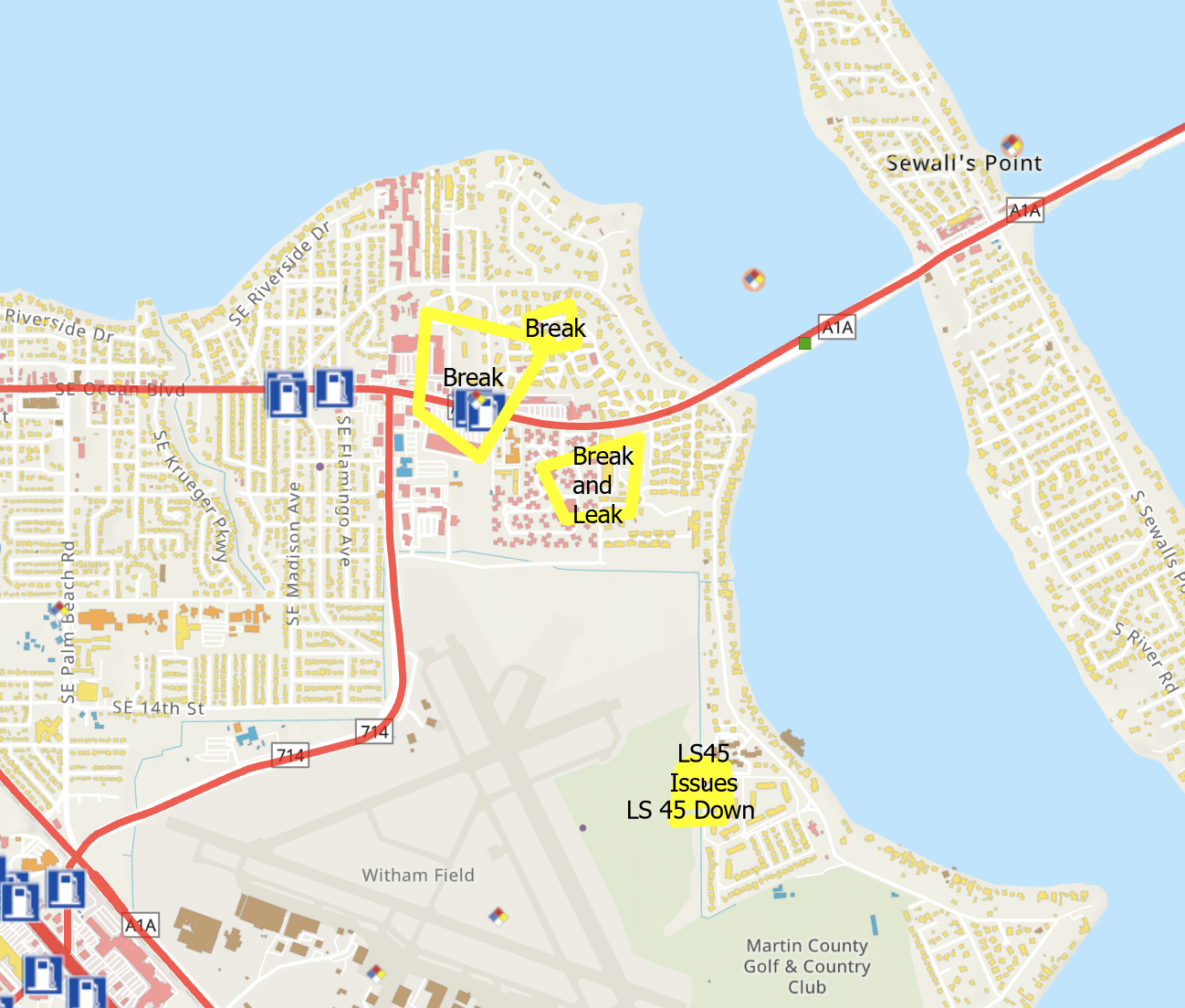
Utility network analysis displaying break locations, leak areas, and lift station issues mapped across the service territory with automatic impact zone identification.
Satellite Imagery Overlay
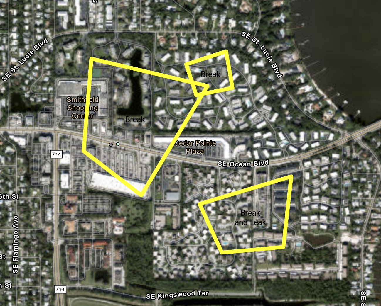
Satellite imagery showing precise outage boundaries, helping field crews visualize affected neighborhoods and plan optimal access routes.
Infrastructure Detail View
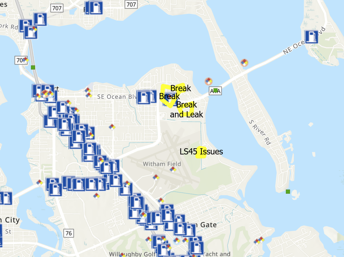
Comprehensive view displaying utility assets, break locations, and service interruptions with street-level context for accurate crew dispatch.
How Our Products Work Together
UOMS connects to ArcGIS Utility Network to manage outages and coordinate emergency response.
UOMS outage flow
- • Outage reports from crews
- • Network model
- • Customer records
Runs network traces, assigns work, and manages notifications
Crew routes, customer messages, live status dashboards
Coordinate field crews and customer communication from one utility focused workspace.
Frequently Asked Questions
What is UOMS?
UOMS is a real-time utility outage management system that integrates with ArcGIS Utility Network to automatically identify affected customers, perform network traces, and coordinate emergency response for water, electric, and gas utilities.
How does UOMS integrate with ArcGIS Utility Network?
UOMS connects directly to your ArcGIS Utility Network to perform real-time network tracing and impact analysis. When an outage occurs, UOMS automatically identifies affected valves, customers, and network segments, then sends notifications to impacted users.
Can UOMS work offline for field crews?
Yes, UOMS includes offline-capable mobile apps that allow field crews to access outage maps and update work status even without network connectivity. Changes sync automatically when connection is restored.
What types of utilities does UOMS support?
UOMS supports water, wastewater, electric, and gas utility networks. It works with any Esri Utility Network deployment and can manage multiple utility types within a single organization.
Manage Outages With Confidence
Connect your utility network to real-time communication and field coordination.