PlotPilot
Our flagship mapping platform designed to empower organizations with powerful geospatial capabilities. Available in three tiers to meet your specific needs, PlotPilot leverages ESRI technology to deliver enterprise-grade mapping solutions.
Why Choose PlotPilot?
ESRI Integration
Seamlessly connects with ArcGIS Online, ArcGIS Enterprise, and ArcGIS Pro for complete workflow integration.
Batch Processing
Process multiple maps simultaneously with advanced batch mapping tools for maximum efficiency.
Collaborative
Real-time collaboration features enable teams to work together on mapping projects efficiently.
Enterprise Security
Enterprise-grade security with role-based access controls and secure cloud infrastructure.
Advanced Analytics
Powerful spatial analysis tools including FLUM analysis, zoning studies, and environmental mapping.
Customizable
Flexible configuration options and custom workflows to match your organization's specific needs.
PlotPilot Pro
Our premium geospatial solution with advanced customization for professional cartographers and GIS specialists. PlotPilot Pro offers the full power of ESRI's ArcGIS technology with additional tools and features developed by Canopy Mapping.
- Advanced spatial analysis and modeling capabilities
- Custom workflow automation tools
- Enterprise-grade data management
- Seamless integration with ArcGIS Pro and ArcGIS Online
- Dedicated technical support and training
- Batch mapping and processing tools
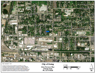
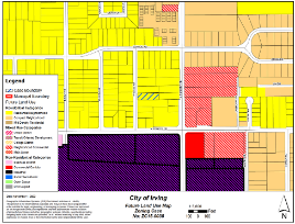
- FLUM (Future Land Use Map) analysis
- Environmental and regulatory compliance tools
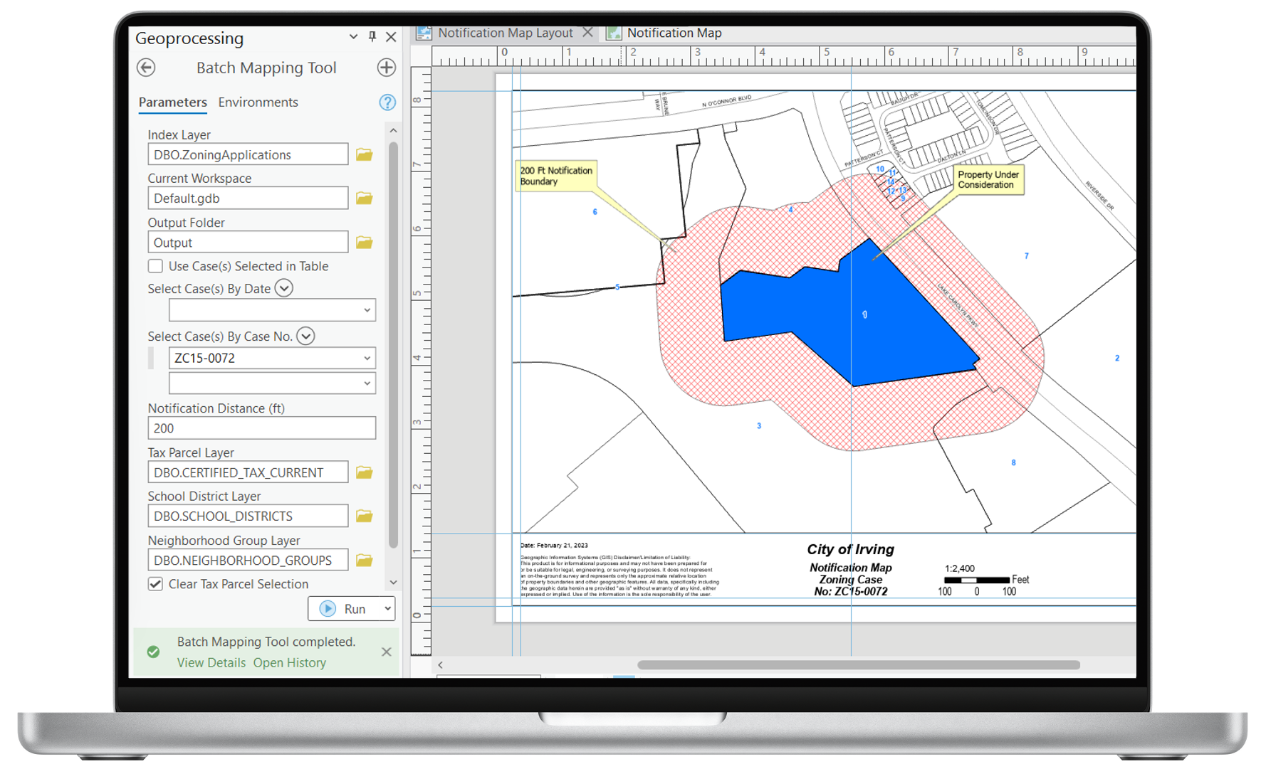
Process multiple maps simultaneously with advanced batch operations, saving hours of manual work.
Comprehensive Future Land Use Map analysis with regulatory compliance and environmental impact assessment.
Compare PlotPilot Tiers
| Feature | PlotPilot Online | PlotPilot SME | PlotPilot Pro |
|---|---|---|---|
| Base Maps | Standard | Enhanced | Premium |
| Spatial Analysis | Basic | Advanced | Enterprise |
| Data Storage | 5GB | 50GB | Unlimited |
| User Accounts | Up to 5 | Up to 20 | Unlimited |
| Batch Processing | — | Limited | Full Access |
| FLUM Analysis | — | — | ✓ |
| Floodplain Mapping | — | ✓ | ✓ |
| Custom Workflows | — | Limited | Full Access |
| API Access | — | Basic | Advanced |
| Support Level | Community | Business Hours | 24/7 Priority |
| ESRI Integration | ArcGIS Online | ArcGIS Online & Enterprise | Full ESRI Stack |
Use Cases
Municipal Planning
Local governments use PlotPilot Pro to manage zoning, infrastructure planning, and public services with comprehensive spatial analysis and FLUM capabilities.
Learn moreEnvironmental Consulting
Environmental firms leverage PlotPilot SME for floodplain analysis, regulatory compliance, and environmental impact assessments.
Learn moreField Operations
Field teams use PlotPilot Online to access and update maps in real-time, improving coordination and data collection efficiency with cloud-based collaboration.
Learn moreReady to get started with PlotPilot?
Contact our team to discuss which PlotPilot tier is right for your organization and schedule a personalized demo.